A Pilgrimage from Norwich to Walsingham
Sharon Sewell walked from Norwich Anglican Cathedral to Walsingham along the Walsingham Way. This is her story.
Norwich to Drayton
I began my pilgrimage by collecting my way marker that can be found in the Cathedral Shop, which opens at 9am. From there, I made my way to the Marriott's Way. The directions were confusing as way markers were fairly sparce. I think I found two (and another which had been partially picked off the post by some bright spark). However, if you go through the arch in front of the Cathedral and walk to the right, crossing the road and continuing down Wensum Street, passing over the bridge, you will eventually come to a road sign Colgate, where you take a left. Continue along Colgate, turning right at Duke Street. Walk Down Duke Street until you come to a crossroads and take a left onto St Mary Plain. When you come to a T junction, turn right onto Oak Street and then left onto New Mills Yard. You then come to Riverside Walk, where you bear right onto a pleasant walk alongside the river. You then cross the main road and take a left beside the roundabout. This leads you to Marriott's Way.
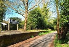
Marriot's Way runs along an old railway line. Many people use it as a means of walking or cycling to Drayton. I found that it was used by cyclists, families and dog walkers and felt quite safe. The beginning of the way was more industrial, with housing and an industrial site on its sidelines. These then petered out into the countryside, leaving the city behind. There are opportunities to take a woodland walk to the right, which brings you back onto the Marriot way. Later, a nature reserve can be visited on the left. At Drayton, The Red Lion Public House is close by for refreshments as are several shops. Beyond the Red Lion is St Margaret's Church.
Drayton to Ringland
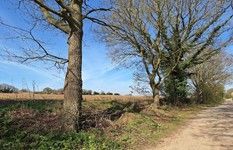
From St Margaret's church, head back, past the Red Lion and cross the Fakenham road. Head up the hill at Taverham Road and there will be a Walsingham Way sign pointing to the right. This is also signed the Walsingham cycle route. Once again, you are following an old railway line. There are now fewer people but it feels safe and there are regular signs along the way. You travel for quite some time, through Thorpe Marriott and cross a bridge over the busy A1270 where you bear left. At a roundabout you will find a WW signpost instructing you to go straight ahead, parallel with the A1270. I began to think I had taken a wrong turn when I saw a closed gate ahead of me. However, once reaching the gate there is a WW sign that guides you into the woods where you head to the top of a hill. Here, the noise of the traffic lessens, and it is peaceful with shaded woods.
Coming down out of the woods, you cross the fairly busy Fakenham road and go straight onto a farm track. At the farm there is a private sign on the right, go left and look to your right where you will see a gate with a ww sign on it. This leads you across a pretty water meadow and to a wooden bridge where you cross over the River Wensum. Once across the field, walk along The Street towards Ringland. You will come to a fork in the road; remain on the right and you will enter Ringland. Once on the T junction with the main road in Ringland, a short detour to the left will take you to St Peter's church. To the right will allow you to continue along Ringland Lane which leads into Morton Lane. Continue through Easthaugh and onwards. On reaching Rectory Road, I took a detour towards Lyng, where St Margaret's Church can be found. Next to the Church is The Fox, where refreshment can be had. It has a garden which overlooks the church. Returning to Easthaugh Road, take a right and continue down the road. you will come to a T junction. Cross the road and follow the track through cool woods and then a pathway that ends on Heath Road where a left will take you Elsing. St Mary Church can be found at the end of Church Road.
I stayed at Bartles Lodge for the night. It is quiet and serves cooked breakfast. Dinner can be booked ahead, and you are welcome to take any items left on the buffet breakfast as pack up for the journey. I spent some time in contemplation, walking around the three fishing lakes on the grounds. Alternatively, I have since found that it is possible to sleep in the village hall, by arrangement. A waymark stamp is available at the church by arrangement with the Church Warden. This part of the walk, with a few detours registered at 29.63 km or 18.5 miles.
Elsing to Great Ryburgh
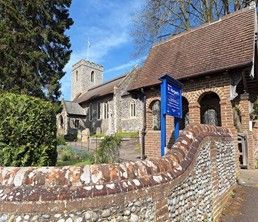
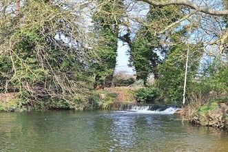
With your back to the Church, turn left and walk down Church Street, leading on to Elsing Road. Stay to the right at the triangle and continue on Elsing Road until you reach Swanton Morley, where you can find Darbys Pub for refreshment and Swanton Morley Stores for supplies. The B1147 is a busy road. All Saint's Church can be found by staying on the path opposite Darbys Pub and following the B1147 through the village. As you come out of the village, you will see All Saints Church on a small hill to the right. The church has a lot of information about the soldiers from Swanton Morely that died during World War 1. To continue your way, return to the path and cross the road to walk up Rectory Road, which faces you. This leads into Hannah Road and will take you out of the village. As you exit the village take a right up Primrose Lane, which leads you into the wide countryside. On a right-hand bend, where Primrose Lane becomes Primrose Hill, you will be guided onto a countryside track, which leads you across the fields and, eventually to Worthing Road. Take a right here. If you are wanting a rest, continue past the WW sign guiding you to the right and after a few metres, just around the corner, you will come to Swanton Morely Waterfalls. There is a small picnic field by the waterfalls that is open to the public,
If you visit the waterfalls, return to the WW sign you passed, that guides you along Worthing Road. This is quite a long road but is peaceful. After quite some time, you have the choice of taking a detour up Church Road to St Margaret Church Worthing, in which case you will need to return to this point or take the right bend and walk along the Worthing Road, which will lead you to a T junction with the B1145. If you follow this going left, it will lead you into North Elmham. In North Elmham there are places to eat and buy supplies. Take a right after the King's Head Hotel and you will pass North Elmham Stores and Elmham Tea Post, eventually coming to St Mary's Church. North Elmham Chapel is also worth a visit. Exiting North Elmham, there is the entrance to a gated path, next to a red telephone box. Further down the path you are guided across a field and back into the country. The exit gate leads to Great Heath Road where you bear right and then take the next left. This road is quiet When you reach a three-way junction, stay to the right and you will eventually join Mill Road, which will lead you into Great Ryburgh. The Blue Boar is no longer open, however, there is pilgrim accommodation next to St Andrews Church.
I stayed in the pilgrim accommodation and was warmly met with tea and cake by Anne, the Church Warden. Anne could not have been more generous, making sure I was fed and watered. There are cooking facilities and somewhere to wash. I thought I would be sleeping on the floor, but a camp bed was provided. The village hall is also made available, by arrangement, for larger groups. It is possible to get a waymark stamp from the church as it is made available in the church. Whilst collecting the waymark stamp, it is worth setting some time aside to look around St Andrews church which has a display regarding the meaning of being a pilgrim, soldiers from the village that gave up their lives in World War 1 and the architectural history of the church. This part of the walk registered at 19.69 km or 12.3 miles long,
Great Ryburgh to Walsingham.
Ryburgh is left via Bridge Road. Leave the church and turn right immediately before the Blue Boar. I took a detour at the next left signposted 'cemetery'. At the top of the hill, there are the remains of Little Ryburgh medieval parish church, which was used until the mid-1700s. Each Easter Sunday morning, a service is still held around the angel. Returning back to the route, take a left, along Bridge Road and this will eventually go over the A1067. Almost opposite and to the left, you are guided to a quieter road. As you corner to the left there is a right of way, the other side of the hedge (apparently many people miss this). On exiting the right of way, you enter Stibbard. At Stibbard is All Saints church. Continue with All Saints church to you right for some time. You will reach Pedlar's lane on the right. Take a left here on a track that will lead you through vast, open fields. The track ends with a rather large house in front of you. A few meters to the left are the ruins of an old church, taken over by nature. It is to the right that the route continues until a road is reached. This road and the WW way markers guide you through Croxton into Little Snoring, where you will find Saint Andrews Church with its round tower which is mainly 11th Century and is separate from the church. The church was enclosed in the perimeter of the air base during World War 2 and was used as the base chapel.
Return to the road from Saint Andrews Church and continue along Little Snoring Road. You will eventually cross over the river Stiffkey. Continue along the road and go straight over at the crossroads into The Street at Great Snoring. The Church of st Mary the Virgin will be passed on the left . Continue along The Street and take a left onto Barsham Road. You will the be guided onto a right of way on the right, next to a footpath which will continue on to the Fakenham Road. The Fakenham Road can be quite busy and another right of way, behind the hedge allows safe passage along Fakenham Road. At the time of writing, the passage was becoming overgrown but was passable, bringing you out further along the Fakenham Road. Just before some private ruins is Blind Dick's Lane on the left. This lane is quieter than the main road. A right turn will then take you along Back Lane and into Walsingham. This part of the walk registered at 19.18 km or 12 miles.
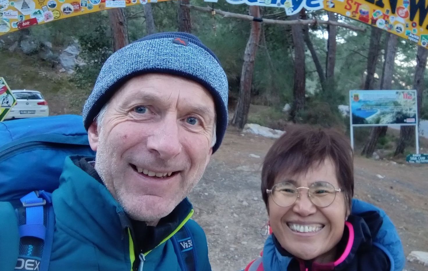
Sharon Sewell
NB Sharon walked the Walsingham Way. The Hearts in Search of God route from Norwich to Walsingham can be found here: The Way of the Annunciation